A Living Systems Commons for the Town of Brighton, NY
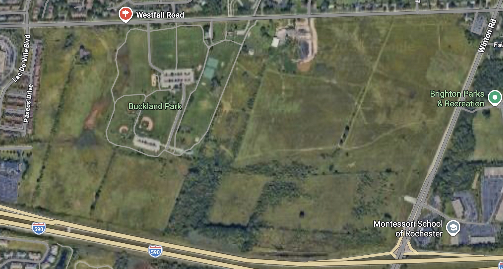
Site: Town-owned 27-acre parcel on Westfall Road
Municipality: Brighton
Purpose: Transform a municipally owned parcel into a high-visibility ecological demonstration landscape that integrates watershed protection, climate resilience, education, and community wellbeing — while serving as a replicable model for suburban regeneration.
1. Why This Site Matters
The Westfall Road parcel sits at the intersection of:
- Suburban land-use pressure
- Stormwater and watershed responsibility (Irondequoit Creek system)
- Climate adaptation needs
- Public trust land stewardship
Rather than treating this land as a residual asset or future development reserve, Brighton has a rare opportunity to:
Make the invisible systems that sustain the town visible, functional, and teachable.
This site can become a living laboratory — not a park in the conventional sense, but a working landscape that performs ecological services while inviting public learning.
2. Core Design Principle
Design the land to do real work first — and invite people in second.
This is not an ornamental green space. Every acre should:
- Slow, sink, clean, and cool water
- Sequester carbon and build soil
- Reduce downstream nutrient loading
- Demonstrate climate-smart land management
- Support biodiversity and human presence
3. Programmatic Framework (What Goes Where)
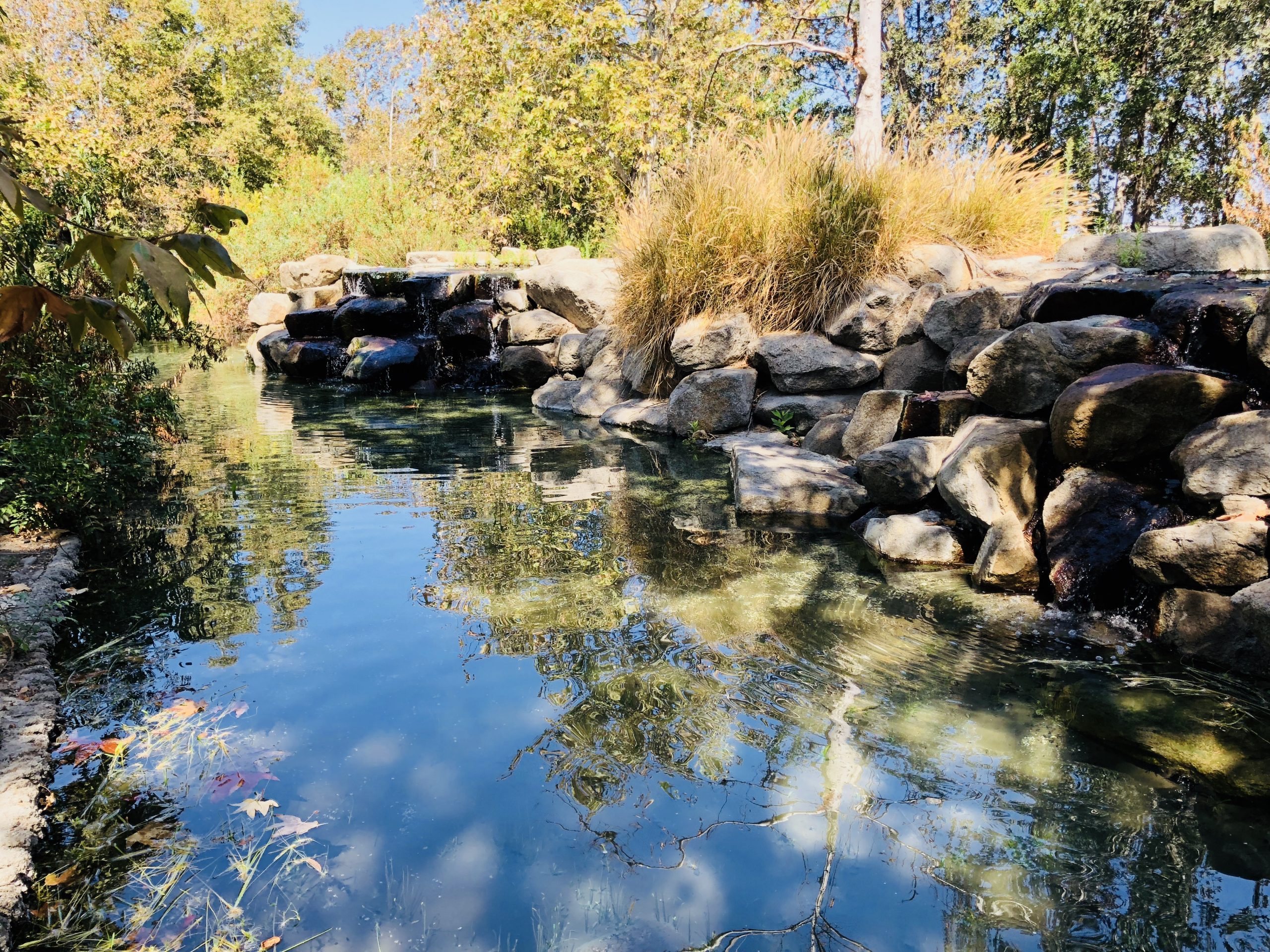
A. Watershed & Stormwater Spine (8–10 acres)
Primary function: Water management and downstream protection
Elements:
- Constructed wetlands and wet meadows
- Floodplain reconnection zones
- Bioswales and retention basins sized to real storm events
- Native riparian plantings
Outcomes:
- Measurable reduction in runoff volume and nutrient load
- Demonstration of nature-based stormwater infrastructure
- Direct contribution to Irondequoit Bay water quality goals
This zone should be instrumented (simple sensors + monitoring) so the town can say:
“This land is actively protecting our watershed.”
B. Climate & Canopy Commons (6–8 acres)
Primary function: Heat mitigation, carbon drawdown, habitat
Elements:
- Mixed native forest plantings (canopy, understory, shrub)
- Pollinator meadows and successional habitat
- Microclimate design (shade, wind buffering)
- Carbon-smart land management practices
Outcomes:
- Local heat reduction
- Carbon sequestration (tracked qualitatively or quantitatively)
- Visible biodiversity gains
- Model for suburban reforestation and habitat stitching
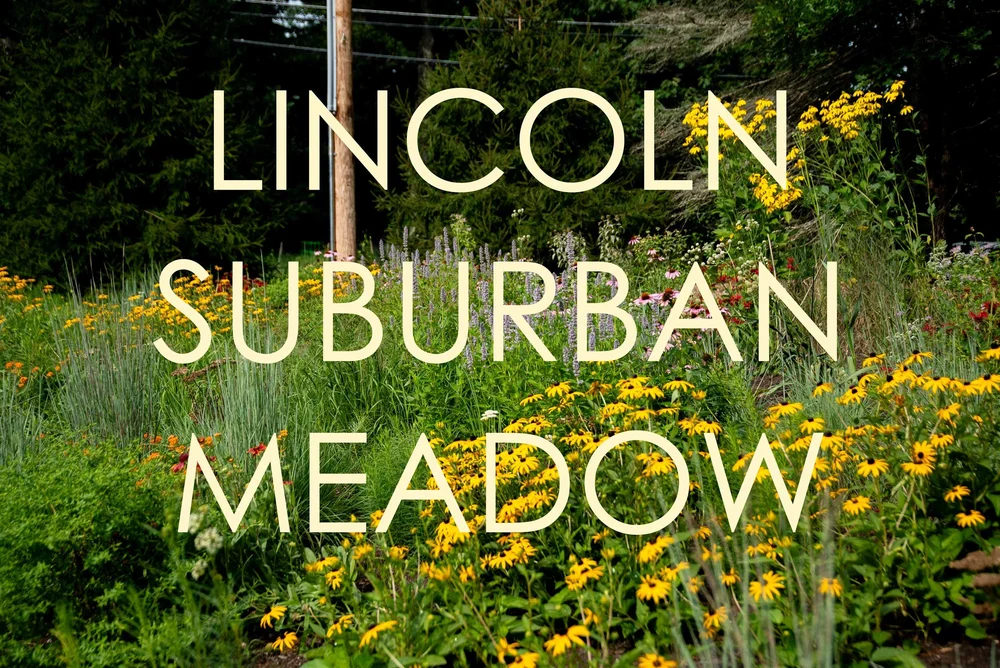
C. Regenerative Landscape Demonstration Zone (4–5 acres)
Primary function: Education + applied ecology
Elements:
- Regenerative meadow management
- Soil restoration plots
- Native perennial food or medicinal plant guilds
- Small-scale agroecology demonstrations (non-commercial)
Outcomes:
- Hands-on learning for schools and residents
- Transferable practices for homeowners, HOAs, and institutions
- A bridge between “nature preserve” and “working land”
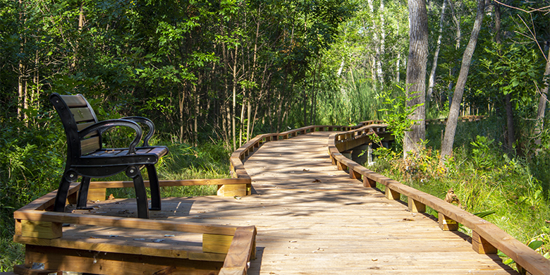
D. Human Access, Learning & Reflection Network (3–4 acres)
Primary function: Public engagement without ecological degradation
Elements:
- Permeable walking loops
- Elevated boardwalks through sensitive areas
- Outdoor classroom / pavilion (simple, low-impact)
- Interpretive signage focused on systems, not slogans
Outcomes:
- High public value without heavy infrastructure
- ADA-accessible learning
- Quiet recreation aligned with stewardship

4. What This Is Not
It is not:
- A sports complex
- A traditional playground
- A passive “set aside and forget” conservation parcel
- A branding exercise without performance metrics
This project earns its legitimacy by measurable ecological function.
5. Governance & Stewardship Model
To succeed, this should not be managed as a conventional park alone.
Recommended structure:
- Town ownership retained
- Stewardship partnership with:
- Local conservation or restoration organizations
- Educational institutions
- Watershed groups
- Clear ecological performance goals reviewed annually
Think “living infrastructure,” not “amenity.”
6. Funding & Phasing Strategy
Phase 1: Ecological Design & Baseline (Year 1)
- Site hydrology and soils assessment
- Ecological master plan
- Community listening sessions
- Baseline water, soil, and biodiversity metrics
Phase 2: Core Systems Build-out (Years 2–3)
- Wetland and stormwater features
- Initial canopy and meadow establishment
- Access pathways
Phase 3: Learning & Replication (Years 3–5)
- Educational programming
- Monitoring and storytelling
- Replication toolkit for other Brighton parcels
Funding sources could include:
- NYS environmental and climate grants
- Watershed protection funding
- Philanthropic foundations
- Municipal capital + in-kind support
7. Why This Is a Smart Move for Brighton
This project would:
- Reduce downstream environmental risk
- Advance Brighton’s Climate Action Plan in reality, not just on paper
- Create a visible symbol of ecological responsibility
- Provide long-term value without high operating costs
- Position Brighton as a leader among first-ring suburbs
Most importantly, it would answer a quiet civic question:
What does it look like when a town takes responsibility for the land it holds?
8. Next Logical Steps (If the Town Is Serious)
- Pass a resolution of intent: ecological demonstration, not future development
- Commission an ecological site assessment
- Appoint a cross-sector steering group
- Secure seed funding for design
- Treat the site as a learning system, not a finished product
If you want, next I can:
- Turn this into a formal proposal memo
- Draft a town board resolution
- Create a design brief for landscape architects and ecologists
- Map this explicitly to Irondequoit watershed goals
- Or pressure-test this against political and fiscal realities
This land is an opportunity to tell the truth about what sustains Brighton — and act on it.
If you’d like to comment on this, please do so below. This is an informal proposal, not yet vetted by anyone, and not yet presented to the municipality.
1 thought on “Westfall Road Ecological Demonstration Project – Concept Proposal (1/20/2026)”